

-

The Triumph of the Passenger Ship - An Exhibition of the Norman H. Morse Ocean Liner Collection
Osher Map Library
Triumph of the Passenger Ship: Highlights from the Norman H. Morse Ocean Liner Collection, 1870-2010.
May 15, 2012 to August 23, 2012
The experience of life aboard the great vessels that plied the Atlantic, from the introduction of steam to the rise of air travel, is presented through this selection of materials from the Morse Collection of ocean liner ephemera.
-

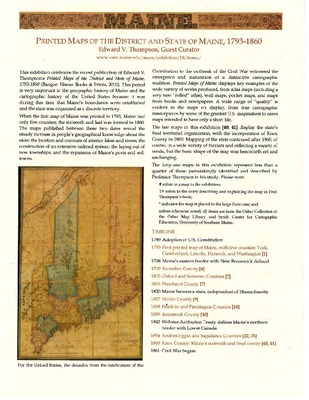
Printed Maps of the District and State of Maine, 1793-1860
Osher Map Library
Printed Maps of the District and State of Maine, 1793-1860.
March 8, 2011 to August 25, 2011
The early printed maps of Maine reveal the development of the state through expanding population and economy. They encompass a wide variety of works, from formal atlas and wall maps to ephemeral pocket maps and maps in newspapers.
Edward V. Thompson, Guest Curator.
-

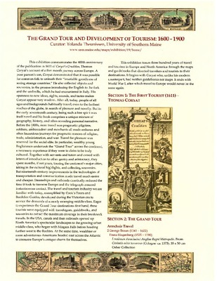
The Grand Tour and Development of Tourism: 1600-1900
Osher Map Library
The Grand Tour and Development of Tourism, 1600 to 1900.
October 4, 2011 to April 28, 2012
The 400th anniversary of Thomas Coryat’s "Crudities" (1611), the first tourist memoir, is celebrated by this history, to 1918, of the European tourism industry and the development of guidebooks and maps.
Curated by Yolanda Theunissen, USM.
-

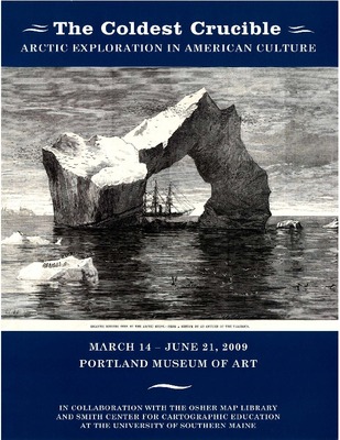
The Coldest Crucible - Arctic Exploration in American Culture
Portland Museum of Art and Michael F. Robinson
The Coldest Crucible - Arctic Exploration in American Culture.
March 14, 2009 to June 21, 2009
In the late 1800s, “Arctic fever” swept the nation as dozens of American expeditions sailed north to find a sea route to Asia and, ultimately, to stand at the North Pole. This exhibition paints a new portrait of these polar voyagers by placing them within the tempests of American cultural life.
In collaboration with the Osher Map Library and Smith Center for Cartographic Education, University of Southern Maine.
-

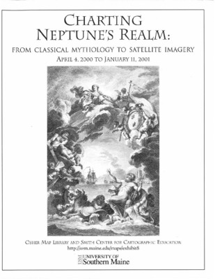
Charting Neptune's Realm: From Classical Mythology to Satellite Imagery
Osher Map Library and Smith Center for Cartographic Education
Charting Neptune's Realm: From Classical Mythology to Satellite Imagery.
April 4, 2000 to January 11, 2001
The charts in this exhibition explore how mariners have distinguished one piece of water from any other, by determining what phenomena can be delineated across the vast, trackless ocean and by developing notations to express those phenomena.
-

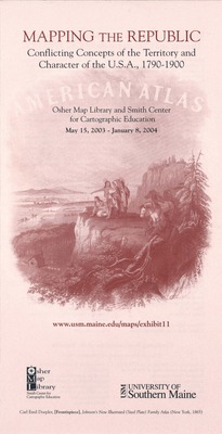
Mapping the Republic - Conflicting Concepts of the Territory and Character of the U.S.A., 1790-1900
Osher Map Library and Smith Center for Cartographic Education
Mapping the Republic.
May 13, 2003 to May 29, 2004
Nineteenth-century maps of the U.S.A. embodied a truly important conflict in how Americans understood the republic: is it a collection of sovereign states or an expansive Union?
Curated by Prof. Matthew H. Edney.
-

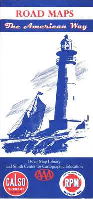
Road Maps - The American Way
Osher Map Library and Smith Center for Cartographic Education
Road Maps - The American Way.
February 13, 2001 to December 21, 2001
U.S. road maps have always emphasized a proud national history and have promised a glorious future, through the magic of the automobile. So get out the road map to plot your course . . . and don't forget to buy our brand of gas!
Guest Curator - Robert French.
-

Worldly Treasures - A Fifth Anniversary Celebration
Osher Map Library and Smith Center for Cartographic Education
Worldly Treasures - A Fifth Anniversary Celebration.
October 4, 1999 - March 25, 2000
What Makes a Map a Treasure? Worldly Treasures features significant recent additions to the collection, most of them gifts from a variety of donors.
Curated by Prof. Matthew Edney, Dr. Harold L. Osher, George S. Carhart, Albert A. Howard, et al.
-

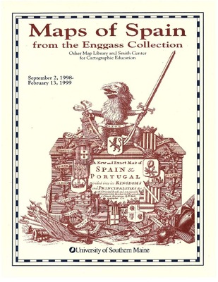
Maps of Spain from the Enggass Collection
Osher Map Library and Smith Center for Cartographic Education
Maps of Spain from the Enggass Collection.
September 2, 1998 to October 6, 1999
An exhibition tracing the cartographic evolution of Iberia through a series of maps, from 1486 through 1829, donated by Dr. Peter M. Enggass, professor emeritus of Geography and Geology, Mt. Holyoke College.
-

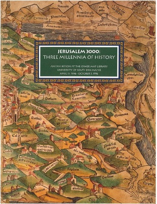
Jerusalem 3000: Three Millennia of History
Osher Map Library
Jerusalem 3000: Three Millennia of History. April 17, 1996 to October 5, 1996
Sacred to Jews, Christians, and Moslems, the city has inspired a prodigious outpouring of prose and poetry, artistic renderings, and, of course, maps. This exhibition offers a selection of maps and views to celebrate the 3000th anniversary of Jerusalem's establishment as the capital of King David's unified Kingdom of Israel.
-

Maine 175 - A Celebration of 175 Years of Maine Statehood
Osher Map Library and Smith Center for Cartographic Education
Maine 175 - A Celebration of 175 Years of Maine Statehood.
September 5, 1995 - January 28, 1996
This exhibition is designed to celebrate the 175th anniversary of Maine statehood using maps and other artifacts.
Maps and their creators have played an important role in the history of Maine from the time of the first visits by European mariners to the present. Explorers and mapmakers struggled first to take the measure of the land and then used maps to take possession of it. French and English officials put forward conflicting claims to Maine in the form of maps, as did the Americans and English in their boundary disputes.
Curated by Joel W. Eastman.
-

The Land of Norumbega - Maine in the Age of Exploration and Settlement
Maine Humanities Council
The Land of Norumbega - Maine in the Age of Exploration and Settlement.
An Exhibition by Susan Danforth, Maine Humanities Council, Portland, Maine 1988.
This exhibition began in 1986, when the University of Southern Maine received an extraordinary collection of rare maps, atlases, and globes donated by Lawrence M.C. and Eleanor Houston Smith. In 1987, in response to a call from the National Endowment for the Humanities for programs relating to the Columbian Quincentenary, the Maine Humanities Council submitted a proposal for the "Land of Norumbega" project.
Printing is not supported at the primary Gallery Thumbnail page. Please first navigate to a specific Image before printing.


