

Files
Download Full Text (3.8 MB)
Description
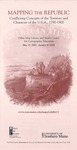
Mapping the Republic.
May 13, 2003 to May 29, 2004
Nineteenth-century maps of the U.S.A. embodied a truly important conflict in how Americans understood the republic: is it a collection of sovereign states or an expansive Union?
Curated by Prof. Matthew H. Edney.
Document Type
Book
Publication Date
5-2003
Publisher
Osher Map Library - University of Sothern Maine
City
Portland, Maine
Keywords
Cartography of the United States, Early American Maps, Manifest Destiny, Early American Gazetteers and Atlases
Disciplines
Geography | History | Political History | United States History
Recommended Citation
Osher Map Library and Smith Center for Cartographic Education, "Mapping the Republic - Conflicting Concepts of the Territory and Character of the U.S.A., 1790-1900" (2003). Osher Map Library Exhibition Catalogs. 5.
https://digitalcommons.usm.maine.edu/oml_exhibits/5
Creative Commons License

This work is licensed under a Creative Commons Attribution-Noncommercial-No Derivative Works 4.0 License.


