

Files
Download Full Text (1.1 MB)
Description
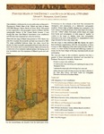
Printed Maps of the District and State of Maine, 1793-1860.
March 8, 2011 to August 25, 2011
The early printed maps of Maine reveal the development of the state through expanding population and economy. They encompass a wide variety of works, from formal atlas and wall maps to ephemeral pocket maps and maps in newspapers.
Edward V. Thompson, Guest Curator.
Document Type
Book
Publication Date
3-2011
Publisher
Osher Map Library - University of Sothern Maine
City
Portland, Maine
Keywords
State of Maine, District of Maine, Early New England Maps, Maps of Maine, Commonwealth of Massachusetts
Disciplines
Geography | History | United States History
Recommended Citation
Osher Map Library, "Printed Maps of the District and State of Maine, 1793-1860" (2011). Osher Map Library Exhibition Catalogs. 6.
https://digitalcommons.usm.maine.edu/oml_exhibits/6
Creative Commons License

This work is licensed under a Creative Commons Attribution-Noncommercial-No Derivative Works 4.0 License.


