

-

Portland Waterfront Sign: A Dirty History of Casco Bay
Casco Bay Estuary Partnership and Montgomery Designs
-

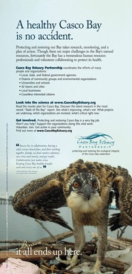
Portland Waterfront Sign: A Healthy Casco Bay is no Accident
Casco Bay Estuary Partnership and Montgomery Designs
-

Portland Waterfront Sign: Casco Bay’s Four Thousand Years of Sustainable, Stable Productivity
Casco Bay Estuary Partnership and Montgomery Designs
-

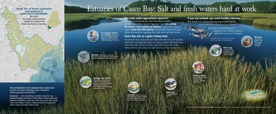
Portland Waterfront Sign: Estuaries of Casco Bay: Salt and Fresh Waters Hard at Work
Casco Bay Estuary Partnership and Montgomery Designs
-

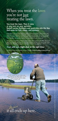
Portland Waterfront Sign: The Little Things You do at Home Can Make a Big Difference Here in the Bay
Casco Bay Estuary Partnership and Montgomery Designs
-

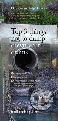
Portland Waterfront Sign: Top Three Things Not to Dump Down Your Drains
Casco Bay Estuary Partnership and Montgomery Designs
-
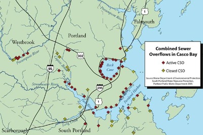
 by Maine Department of Environmental Protection, South Portland Water Resource Protection, and Portland Public Works")
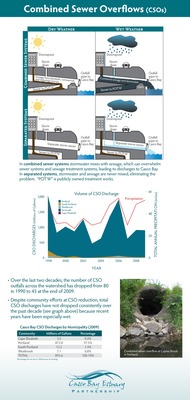
Combined Sewer Overflows in Casco Bay (Map)
Maine Department of Environmental Protection, South Portland Water Resource Protection, and Portland Public Works
-
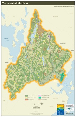
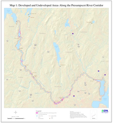
 by Presumpscot River Watershed Coalition and Casco Bay Estuary Partnership")
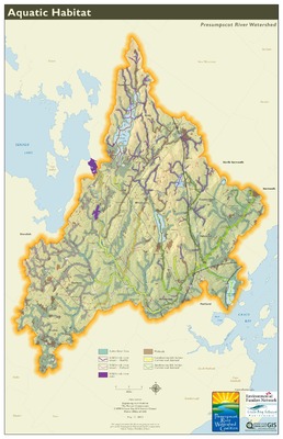
Presumpscot River Corridor Map 1: Developed and Undeveloped Areas (Map)
Presumpscot River Watershed Coalition and Casco Bay Estuary Partnership
-
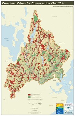
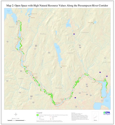
 by Presumpscot River Watershed Coalition and Casco Bay Estuary Partnership")
Presumpscot River Corridor Map 2: Open Space with High Natural Resource Values (Map)
Presumpscot River Watershed Coalition and Casco Bay Estuary Partnership
-
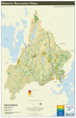
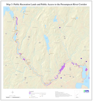
 by Presumpscot River Watershed Coalition and Casco Bay Estuary Partnership")
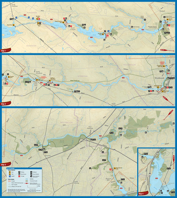
Presumpscot River Corridor Map 3: Public Recreation Lands and Public Access (Map)
Presumpscot River Watershed Coalition and Casco Bay Estuary Partnership
-
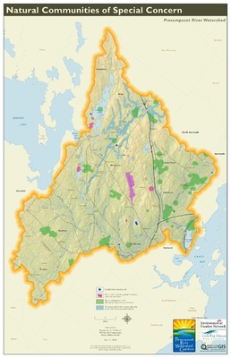
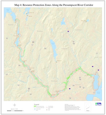
 by Presumpscot River Watershed Coalition and Casco Bay Estuary Partnership")
Presumpscot River Corridor Map 4: Resource Protection Zones (Map)
Presumpscot River Watershed Coalition and Casco Bay Estuary Partnership
-
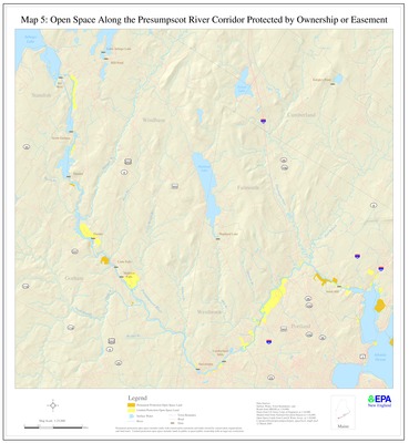
 by Presumpscot River Watershed Coalition and Casco Bay Estuary Partnership")
Presumpscot River Corridor Map 5: Open Space Protected by Ownership or Easement (Map)
Presumpscot River Watershed Coalition and Casco Bay Estuary Partnership
-
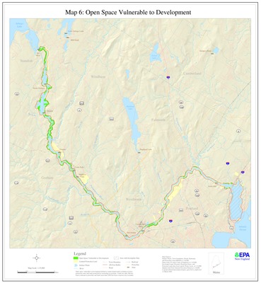
 by Presumpscot River Watershed Coalition and Casco Bay Estuary Partnership")
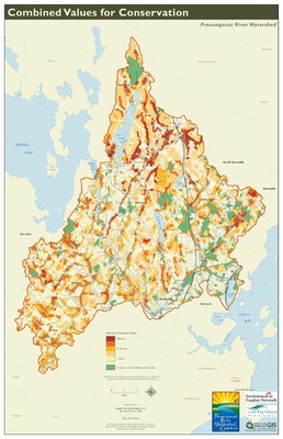
Presumpscot River Corridor Map 6: Open Space Vulnerable to Development (Map)
Presumpscot River Watershed Coalition and Casco Bay Estuary Partnership
-
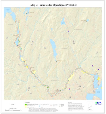
 by Presumpscot River Watershed Coalition and Casco Bay Estuary Partnership")
Presumpscot River Corridor Map 7: Priorities for Open Space Protection (Map)
Presumpscot River Watershed Coalition and Casco Bay Estuary Partnership
Printing is not supported at the primary Gallery Thumbnail page. Please first navigate to a specific Image before printing.
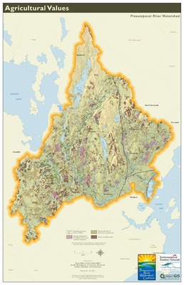
 by Casco Bay Estuary Partnership")
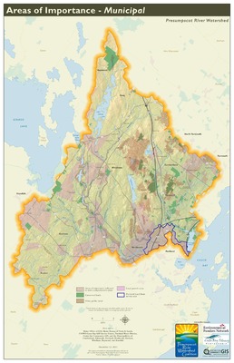
 by Casco Bay Estuary Partnership")
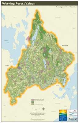
 by Casco Bay Estuary Partnership")


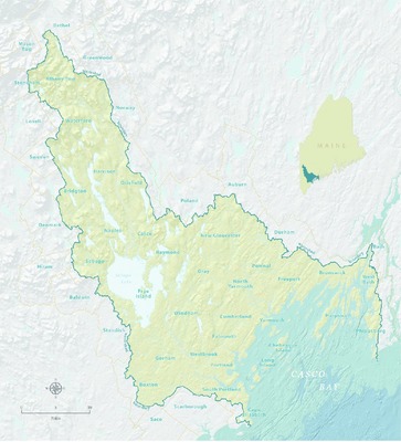
 by Casco Bay Estuary Partnership")


